

What is a Boundary Survey and Why Do You Need One?
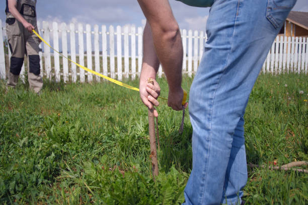
A boundary survey is a crucial tool for landowners, buyers, and real estate investors to determine the precise legal boundaries of a property. Whether you are purchasing a new property, resolving a dispute, or planning construction, understanding “what is a boundary survey” can save you time, money, and legal troubles. Without a clear understanding of property boundaries, homeowners and developers may unknowingly encroach on adjacent land, leading to costly legal disputes.
Land ownership is one of the most valuable assets a person can have, but it comes with responsibilities. One of these responsibilities is ensuring that you fully understand the limits of your land. A boundary survey is an essential step to confirming ownership and preventing boundary conflicts. In this article, we’ll explore “what is a property boundary survey,” when you need one, the process involved, costs, and how it helps protect your property rights.
What Is a Boundary Survey?
A boundary survey is a professional assessment conducted by a licensed surveyor to establish the exact lines and corners of a property. It involves researching historical records, maps, and deeds, followed by an on-site evaluation using advanced surveying equipment. The surveyor then prepares a detailed map that clearly defines the boundaries, easements, and any encroachments.
Many people assume that the boundaries of their property are marked by fences or walls. However, this is often not the case. Property boundaries are determined legally, based on recorded plats and surveys, rather than physical markers. A boundary survey removes any uncertainty by providing precise measurements and documentation of where your property starts and ends.
Boundary surveys are commonly used in real estate transactions, construction planning, and legal disputes. Whether you are buying a house, subdividing land, or resolving a dispute with a neighbor, a boundary survey provides an accurate representation of your land.

When Do You Need a Boundary Survey?
You may require a boundary survey in several scenarios:
1. Property Purchase
Before buying land, knowing its exact boundaries prevents disputes and ensures you are getting what you pay for. Buyers who rely solely on property descriptions without a boundary survey risk purchasing land with unclear boundaries, which may lead to future disputes.
2. Building or Renovation
If you plan to build a fence, driveway, or any structure, a boundary survey ensures you stay within your legal limits. Local zoning laws often require homeowners to maintain specific setback distances from property lines, and failing to adhere to these requirements can result in fines or forced removal of structures.
3. Property Disputes
If neighbors have conflicting claims about property lines, a survey can clarify ownership. Many boundary disputes arise because landowners assume their property lines extend further than they actually do.
4. Subdivision and Development
Developers require boundary surveys to divide large tracts of land into smaller lots. Before developing land, accurate boundary measurements ensure compliance with zoning laws and planning regulations.
5. Mortgage or Title Requirements
Lenders and title companies may require a boundary survey to issue loans or title insurance. Many financial institutions will not approve a mortgage without an updated survey that clearly defines property lines.

The Process of Conducting a Boundary Survey
Research:
Fieldwork:
Boundary Marking
Drafting the Survey Map
Final Report
How Much Does a Boundary Survey Cost?
“How much does a boundary survey cost?” varies based on factors such as property size, terrain complexity, and location. On average, the cost ranges from $300 to $2,000. Urban areas with smaller lots tend to be on the lower end, while rural or complex properties may cost more.
Factors affecting boundary survey costs include:
-
Property Size: Larger properties require more time and resources to survey.
-
Topography: Uneven terrain, dense vegetation, and water bodies can complicate the survey process.
-
Accessibility: Remote locations or areas with difficult access may increase costs.
-
Existing Records: If historical records are incomplete or outdated, additional research may be required, increasing costs.

How Long Does a Boundary Survey Take?
The duration of a boundary survey depends on factors like property size, weather conditions, and surveyor availability. Generally, it can take a few days to several weeks to complete. More complex surveys, particularly those involving disputes or unclear historical records, may take longer.
How a Boundary Survey Can Protect Your Property Rights
A boundary survey safeguards your ownership rights by:
-
Preventing disputes with neighbors: Clear property lines reduce the likelihood of conflicts over land usage.
-
Ensuring compliance with zoning and building regulations: Avoiding legal complications ensures that structures are built within legal limits.
-
Protecting against encroachments that could lead to legal conflicts: Encroachments occur when a neighbor unintentionally builds on your property, leading to potential lawsuits.
-
Providing documentation for legal and financial transactions: Official survey records serve as legal proof of ownership and can be used in court if necessary.
Conclusion
Understanding “how to survey land boundaries” is essential for homeowners, investors, and developers. A boundary survey ensures clarity, legal security, and peace of mind when dealing with property matters.
Dwanderful is a real estate investment platform founded by Dwan, a seasoned real estate investor and podcast host. As part of its services, Dwanderful offers a free book titled “Real Estate Lingo” and a paid book called “Five Pillars of Real Estate Investing” to help investors navigate the real estate market successfully. Additionally, you can take part in a quiz game to discover how you could generate six figures in the next six months—whether you’re buying your first property or your next. It takes less than a minute! Contact us now!
Frequently Asked Questions:
Who Can Perform a Boundary Survey?
Only a licensed land surveyor can conduct a legal boundary survey. Each state has specific licensing requirements to ensure accuracy and legal validity.
What Documents Do You Need for a Boundary Survey?
Common documents include:
-
Property deed
-
Previous surveys (if available)
-
Subdivision plats
-
Title insurance records
Can a Boundary Survey Be Used in Legal Disputes?
Yes, boundary surveys serve as legal evidence in property disputes, helping courts and attorneys resolve conflicts over land ownership.
By investing in a boundary survey, property owners ensure accurate land measurements, prevent legal disputes, and secure their real estate investments.